Plecing Kangkung, Special Food from Lombok


Plecing Kangkung, Special Food from Lombok
Plecing kangkung is a typical Indonesian cuisine originating from Lombok. Plecing kangkung consists of a boiled and served in a cold state and fresh shrimp with chili sauce, tomato, sprouts, nuts, and orange juice.

Plecing kangkung is famous for its spicy flavor. For you fans of the spicy dish you must try this one.

Pottery Making Process Typical Lombok Crafts

Pottery Making Process Typical Lombok Crafts

Many smart people work and the results of the work they can continue their lives, though not infrequently from their success of the work, as EXAMPLE crafts. Handicrafts has unique characteristics, so do not be surprised if sometimes more expensive craft even very expensive. On the island of Lombok is popular with the craft of pottery, weaving, wood carvings and stone, gold and pearls. Many villages produce handicrafts to hereditary as Banyumulek village famous for its pottery village, the village is famous for its traditional Sukarare tenunnya, and Labuapi village famous for its carved-carvings.

History of Pottery
Crockery, better known by the name of "pottery" to be one form of fruit and works well as ancestral tradition of hereditary ever and is still preserved as a local resident who has expertise is recognized worldwide. First pottery used for storing rice, salt and spices as well as used for cooking purposes.

Making pottery is the work of mothers and daughters, in turn sell and bring to market is the duty of the father and son. But as time advances so quickly where the majority of fathers and sons take part in the manufacture of pottery work together to obtain maximum results and good quality.

Create a simple pot just is not as easy as people think because it takes a long and winding process, as information, we put forward ways of making pottery is as follows:

1. Search Process clay
Need a thorough inspection to get the best clay in accordance with quality standards. Clay is nice not having to come from the pottery-producing village but comes from a nearby village. Clay is not necessarily used immediately but it took a profound accuracy and ensure that the clay is mixed with small stones and dirt.

2. Drying Process
After inspection, the clay is cut into pieces such as cubes and dried in the sun, it takes about 3 or 4 days. When pieces of the cubes are dried, then ground so as flour dough that is soft and stored before being used as a dough. The most interesting to watch no modern tools that support the manufacture of pottery, but lapisa-layer clay being added from the original amount of dough while the pottery craftsmen rotate objects / tools are used to form the desired object, although its shape as the finished but actually not finished, then there is also a craftsman dedicated to decorate after the object / pots intended allowed to dry in a place not too much sun.

3. The process of varnish with coconut oil
Objects / pots that have been varnished, is a combination of coconut oil and allowed to dry before the Kerik / rubbed with black stone tools or other tradisisonal because it looked shiny surface and again dried diterik sun and it takes one day even rubbed smooth in the mid-afternoon day to add highlights.

4. Combustion Process
Objects / pots ready to be burned and collected into an open oven covered with rice straw is burned for more than 4 hours and the temperature of production of about 400 to 800 degrees Celsius

5. Staining Process
Last job is to choose the right color, if desired scarlet seeds coated with juice and sour red wiggler if desired, simply snapped with chaff.

Since dilaksakan intensive training, by itself the pottery pengarjin more creative in making the patterns, shapes and motifs that you want, so they are ready to compete to the best work with great quality in the world business market.

There are three famous pottery producing village in Lombok, call it Banyumulek in West Lombok, Central Lombok and Penujak Penakak in East Lombok, each having its own characteristics and uniqueness.


The Lombok Sumbawa Pearl Festival 2011


The Lombok Sumbawa Pearl Festival 2011 will be held in Mataram from July 8 to 10, 2011. This event is organized by the Culture and Tourism Ministry and West Nusa Tenggara (Nusa Tenggara Barat / NTB)’s Culture and Tourism Agency.

The Ministry Directorate General, Sapta Nirwandar, said, “This festival is aimed to increase the number of tourists to NTB.”

“It is also part of the Visit Lombok Sumbawa 2012 program, launched by President Susilo Bambang Yudhoyono in 2009,” he added.

According to NTB Governor Zainul Madji, Lombok Sumbawa Pearl Festival which will be held in Hotel Legi Mataram would build an image of Nusa Tenggara Barat as a pearl producer.

“15 international companies have proposed to join and buy the pearls,” said Zainul, “Last year’s festival was attended by 11 companies”.

The annual Lombok Sumbawa Pearl Festival will present pearls-related events such as a pearl auction, exhibition and harvesting, and NTB arts and culture performances. He said he was sure that tourists would be very enthusiast to visit the festival.

A million tourists were expected to come in Lombok Sumbawa Pearl Festival 2011. 60 percent of them would be local tourists.

Lombok Sumbawa Pearl Festival 201

Lombok Sumbawa Pearl Festival 2011Lombok Sumbawa Pearl Festival 2011 will be held on 8 to 11 July 2011 in the area of ​​Senggigi, Lombok, West Nusa Tenggara (NTB).  
The festival is held as an effort to promote Indonesia to the international pearl."The implementation of this event will also encourage foreign tourists to visit Indonesia, especially the NTB.
 According to Seven, the show will open up market access and broader investment opportunities and drive the economy of local communities, especially in tourism and trade. 
In the event that will present potential buyers from 36 foreign and local buyers. "In addition to sightseeing, the buyers will follow the auction pearl cultured pearl farmers from various regions in the country of NTB, Maluku, Ternate, and Papua.

North Lombok Regency

North Lombok Regency

North Lombok Regency
Kabupaten Lombok Utara
—  Regency  —

Seal
Motto: Tioq Tata Tunaq
Location of North Lombok Regency in West Nusa Tenggara
North Lombok Regency is located in Indonesia
North Lombok Regency
Location in Indonesia
Coordinates: 8°21′S 116°9′E / 8.35°S 116.15°E / -8.35; 116.15
 
Coordinates: 8°21′S 116°9′E / 8.35°S 116.15°E / -8.35; 116.15
 
Country Indonesia
Province West Nusa Tenggara
Capital Tanjung
Government
 - Type Kabupaten-Regency
 - Bupati
Area
 - Land 776.25 km2 (299.7 sq mi)
Elevation
at Mount Rinjani summit
max 3,726 m (12,224 ft)
Population
 - Total 210,848
Demographics
 - Ethnic groups Sasak, Balinese, Javanese, Sumbawa people, Flores people
 - Religion Muslim, Hindu, Christian, Buddhist
 - Languages Indonesian (official), Sasak
Time zone WITA (UTC+8)
Website http://www.lombokutarakab.go.id/
 
North Lombok Regency (Indonesian: Kabupaten Lombok Utara) is a Kabupaten of the Indonesian Province of West Nusa Tenggara. It is located on the island of Lombok and the capital is Tanjung situated on the north west coast of the island.
The symbolism behind the Lambang of Kabupaten Lombok Utara, (the regions symbolic logo) is to describe the society of North Lombok as a faithful and obedient people unified under the Republic of Indonesia in a community having a tradition of integrity, religious strength and awareness of the cosmos. These principles providing a strong base for the people of North Lombok to work together in a disciplined and responsible society building a prosperous and ordered community.[1] The motto of the region is "Tioq Tata Tunaq"[1]
 

Location

North Lombok Regency is bounded by the Java Sea to the north, Central Lombok Regency and West Lombok to the south, East Lombok Regency to the east and the Lombok Strait to the west. Central to the region is Mount Rinjani which at 3,726 metres (12,224 ft) is the third highest mountain the second largest volcano in the country and is and an active volcano.[2] The oldest recorded historical eruption was in 1847 and last eruption was in May 2010[3][4][5][6][7][8]
A Sasak village in 1890

History

The Regency of West Lombok was established in 1958 and included the northern section of Lombok now established as the Regency of North Lombok. The West Lombok Administrative Region previously oversaw the West coast, Ampenan, Tanjung, Bayan, Gerung, Gondang and Cakranegara.
In 1993 the West Lombok district was separated into two autonomous regions. As a consequence of the formation of the Government of Mataram in year 2000 the capital of West Lombok was moved from Mataram, West Lombok to Gerung in the south of the district. This move resulted the 5 districts in the northern end of the island being too far away from the services of the West Lombok District at Gerung. Subsequently and with the full support of the local government of West Lombok regency North Lombok established its own regional government situated at Tanjung and the north of the island now functions autonomously from the West Lombok Regency.[9][10] The Regency was ratified Law Number 26 Year 2008, creating the Regency from within the existing boundaries of is a division of the West Lombok Regency .
Central to the region is Mount Rinjani which at 3,726 m is the third highest mountain the second largest volcano in the country and is and an active volcano The oldest recorded historical eruption was in 1847 and last eruption was in may 2010. Gunung Rinjani Observation Post Rinjani Sembalun is located in the village of Lawang, Sub Sembalun 12.5 km (4000 feet) northeast of G. Rinjani). Observers at this post monitor G.Rinjani, and G.Barujari[11][4]

Rinjani eruptive history

Rinjani erupted three times on May 22, 2010 with activity continuing until early on May 23. According to the volcano's official monitoring agency, ash from Mount Barujari was reported as rising up to two km into the atmosphere and damaged crops. The volcano did not threaten villagers at that time. Lava flowed into the caldera lake, pushing its temperature up from 21°C to 35°C, while smoke spread 12 km.[12] In February 2010 observers at the Gunung Rinjani Observation Post located 12.5 km (4000 feet) NE of Rinjani saw one whitish-colored plume that rose 100 metres (328 ft) from the volcano. Dense whitish plumes (and possibly brown) rose 500 metres (1,640 ft) - 900 metres (2,953 ft) in March 2010 on 26 occasions and as high as 1,500 metres (4,921 ft) in April 2010 on 41 occasions. Plumes seen on 1 and 2 May 2010 were "chocolate" in color and rose a maximum height of 1,600 metres (5,249 ft). From February 2010 through April 2010 seismicity decreased, although the maximum amplitude of earthquakes increased. CVGHM (Center of Volcanology and Geological Hazard Mitigation)[13] also noted that ash eruptions and ejected incandescent material fell within Rinjani caldera, but some ash was blown out of the caldera.[14] Please see main Rinjani article for more detail.

Administration

Administrative structure

Right
Kabupaten Lombok Barat (West Lombok Regency) is one of Lombok's four Regencies or administrative regions.
  • TGH M Zainul Majdi, MA., Governor of NTB (West Nusa Tenggara), (Mataram is the Provincial Capital of West Nusa Tenggara).
  • H. Djohan Sjamsu, SH. Regent (Bupati) of Kabupaten Lombok Utara (North Lombok Regency). Inaugurated on 2 August 2010, Tanjung, North Lombok.
  • SH dan H. Najmul Akhyar, SH, MH. Vice Regent (Wakil Bupati) inaugurated 2 August 2010, Tanjung, North Lombok.

Administrative boundaries

Boundary District Regency
North
Java Sea
South Batu Layar
Praya
West Lombok Regency
Central Lombok Regency
West
Lombok Strait
East Praya East Lombok Regency
In late September 2010, a border dispute emerged over the new regional boundaries. Central to the dispute was the new border dividing the North Lombok Regency from West Lombok Regency at a point where it traversed the village of Lembah Sari situated west of Pemenang. Villagers from the 14 hamlets that form Lembah Sari felled a large tree on the side of the main inland road connecting the northern region to that of West Lombok Regency and the City of Mataram so that it formed a roadblock and then manned the roadblock in protest to the boundary alignment. Residents to the decision to move an apparent border between the two districts that followed the line of division between West Pemenang and Lembah Sari. A police detachment later re-opened the road to allow workers from West Lombok Regency to commence work to clear the road. Limited thru traffic was restored after 7 hours of blockade. The North Lombok Regency made public statements to clarify that district authorities would abide by whatever decision was made by the provincial government regarding regional boundaries. 34 villages that were formerly part of West Lombok are now part of North Lombok.[15]

District organisation

North Lombok Regency consists of five Kecamatan or districts. It is bounded by the Java Sea to the north, the West Lombok Regency to the south, Central Lombok Regency to the south and East Lombok Regency on the east side and the Lombok Strait to the west

Kecamatan

  • Bayan
  • Gangga,
  • Kayangan
  • Tanjung
  • Pemenang

Population

The majority of the population are Sasak people. In 2008 East Lombok Regency recorded a total of 1.068.486 persons resident being 494.149 males and 574.337 females.[16]
In 2010 East Lombok Regency recorded 1,081,630 persons in the decennial census, 24.7% being officially below Indonesian poverty level[17] This regency is primarily Muslim, with few people of Balinese origin compared with West Lombok.

Ethnicity

The Sasak people are the indiginous people of Lombok and form the majority of north Lombok's residents. north Lombok is also home to people of Balinese, Chinese, Tionghoa-peranakan people of mixed Indonesian and Chinese descent and small number of Arab Indonesian people, mainly of Yemeni descent who originally settled in the early port city of Ampenan.

Religion

Islam is the religion of the majority population of north Lombok. Other religion's practised in east Lombok are Christianity, Catholicism, Hinduism, Buddhism, and Confucianism.
The northern part of Lombok is home to the Wektu Telu ("Three times"), who as the name suggests pray only three times daily, instead of the five times stipulated in the Quran. Many of the Waktu Telu beliefs are entwined with animism. Waktu Telu has influences not only of Islam, but also Hinduism and pantheistic beliefs. There are also remnants of Boda (people without a religion) who maintain Pagan Sasak beliefs. There is some considerable uncertainty about this though as others believe that the term Buda was simply a pejorative term used by the Islamized Sasak to indicate those groups that refused to convert to Islam. If this hypothesis is true, the remnants of the Boda religion can be seen as representing a kind of original Sasak culture, undiluted by later Islamic innovations.[18] Many influences of animist belief still prevail within the Sasak people and most Sasak people believe strongly in the existence of spirits or ghosts. These original Sask belief systems appear to be much stronger in the Northern areas of Lombok than elsewhere on the island The sasak people regard both food and prayer as indispensable whenever they seek to communicate with spirits, including the dead [19] and many ritualistic traditional Sasak practices still endure despite the influences of both modernity and orthodox Islam. This is discussed in more detail in the Lombok article.

Language

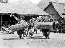
C1934. Traditional male dancers with drums, Lombok
Most people in north Lombok normally the Sasak language. Bahasa Sasak is the native language of the indigenous people of Lombok. Bahasa Indonesian is the language most widely used in everyday interactions at places such as the larger hotels and in the government offices. When at home or a place of recreation north Lombok residents tend to use local northern Lombok dialects of the Sasak language.

Land use

Plantation sector
In August 2010 the Deputy Governor of West Nusa Teggara (NTB), Ir H Badrul Munir, MM, announced in Tanjung, North Lombok Regency, that the District of North Lombok has the potential to be developed as a plantation area, and as a national center for cocoa development in NTB, this region is rich with agricultural commodities such as cocoa, coffee, vanilla, and cloves.[20][21]

Transportation

Small public ferries provide passenger access between Bangsal harbour and the Gili Islands. These are operated by the Sea Transportation Maritime Co-operative (Koperasi Angkutan Laut Karya Bahari). The Koperasi is in principal a community co-operative and they operate three boat services; the Public Boat, the Shuttle boat, the Island Hopping boat and also offer (official) Charter boats. The craft are principally of local design and wooden construction powered by petrol fuelled outboard engines. Prices are set by Kebupaten decree, the pricing of current operations is defined by Pengumuman Dinas Perhubungan Lombok Barat no.:551/662/V/dishub tanggal 26 Mei 2008. Informal private charter services also serve the Bangsal-Gili islands routes and inter-island traffic.
Small high speed passenger craft such as speedboats connect the Gili Islands to Teluk Nare on the Lombok mainland immediately to the east of the Gili islands and Senggigi a little further south along the coast. Speedboat services are also available for local in-shore charters from Teluk Nare a little south of Bangsal and at Gili islands. The majority of the speedboat services are owned and operated by the local hotels and dive shops.
Fast boat services are small high speed craft operating multiple daily scheduled high speed boat services across the Lombok Strait westward to Bali. The craft are of light duty construction having either fibreglass or aluminium hulls and are powered by petrol fuelled outboards. Significant operational and safety issues plague these vessels and the operators.
In August 2010 the Deputy Governor of West Nusa Teggara (NTB), Ir H Badrul Munir, MM, announced plans for the government to assist development in the tourism sector in North Lombok. These plans, including improvements to land and sea transportation infrastructure are intended to assist with the tourist traffic going to the three Gili islands. Improvements are to include safety, convenience and transit time for operations of the public ferry co-operative providing the services crossing between Bangsal and Gili Trawangan[20]
Passenger and vehicle ferries:
  • Lombok Strait: Tanjung Lembar Lombok - Padang Bai, Bali, with 12 ferries providing crossings once every hour.
  • Alat Strait: Labuhan Lombok - Pototano, Sumbawa with 8 ferries providing 18 crossings per day.[22]
These drive on, drive off ferries provide the principal facilities for road transport movements in and out of Lombok. Disruptions on these routes can significantly effect trade and the provision of supplies to the island as the shipping operators on these routes will often suspend services due to breakdown or heavy seas.
Tanjung Lembar seaport in the southwest of the island provides facilities for small freighters and fishing boats.
Public buses and Bemo run both along the west coast from the south and through Pusuk pass to connect to Mataram and Cakranegara. Limited services are available on the east coast to connect to Praya and south toward Kuta.
Selaparang Airport [2]
 
(IATA:
AMIICAO: WADA) is in Ampenan in West Lombok.
Lombok International Airport in Central Lombok is expected to begin operations in 2011 and at that time Selaparang may close.
Limited Helicopter charter is available from Bali and light fixed wing charter is available from both Lombok and Bali.

Tourism

The northern region of Lombok holds two of the islands most significant tourism attractions, Mount Rinjani and the Gili Islands.
On the west coast this touristic region starts just north of the township of Senggigi at Klui beach and runs northward toward the northern townships of Pemenang and Tanjung. Bangsal and Tanjunk Teluk near Pemenang provide services connecting across the short distance of water to the Gili islands off the Sire Penninsular just south of Tanjung. A little further to the north are Bayan and Senaru which offer the main gateways to access Mount Rinjani.
Gunung Rinjani National Park (Taman Nasional Gunung Rinjani) is popular for mountain climbs and trekking and represents an important nature reserve and water catchement area. The park is officially 41,330 hectares within the park boundaries and a further 66,000 hectares of protected forest outside. The mountain and its satellites form the Mount Rinjani National Park (Taman Nasional Gunung Rinjani) - officially 41,000 hectares within the park boundaries and includes a further 66,000 hectares of protected forest outside. In 2008, the Indonesian government proposed to UNESCO that Mount Rinjani be one of the world's official geoparks. If this was approved by UNESCO, Mount Rinjani would become the first such geological park in Indonesia.[23][24][25][26]
  • See the article on Mount Rinjani for more information.
Kosaido Golf Club is an international 18 holes championship course located on the Sire Peninsula in Tanjung. The course has views of Mt. Rinjani to the north east and the Gili Islands across the bay to the west. The course was designed by Peter Thompson, Michael Wolveridge & Perrett and pays respect to the natural onsite contours of the land. The 18 holes championship course offers a basic clubhouse facility and is promoted as having a unique, challenging and world class experience for golfers of all levels. [27]
Rinjani erupting in 1994

Marina facilities

The newly established Medana Bay Marina at Medana Bay near Tanjung has twenty five mooring buoys in more than 5m of water for 35 ft to 45 ft vessels and anchorage space for another twenty vessels.[28] The marina facilities were established in 2009 and hosted over 90 yacht during the Sail Indonesia event in September 2009.

Medana Bay Marina

  • Medana Bay Marina
     
    is at: 8° 21.83'S 116° 07.75'E, (Traditional system: 8°21'50'S 116°07'45'E") and is situated at Medana Bay, Tanjung, North Lombok.
  • The mooring basin is centred on 08°21.833’S and 116°07.750’E with an approach transit point almost due north at 08°20.432’S and 116°07.685’E.
  • A current Sea Chart and sea approach tracks are available on the Marina's website [3]
     
    . Medana Bay is sometimes called Teluk Dalam, meaning Deep Bay.
In late July 2010 participants of Sail Indonesia – Sail Banda 2010 set sail from Darwin Sailing Club in northern Australia. After congregating in Labuhan Bajo on the western tip of Flores in early September 2010 they moved on to Medana Bay on the north-western coast of Lombok prior to moving on to Bali and Kalimantan. Medana Bay was an official stop-over on the itinerary. [29] A repeat of the event is anticipated in 2011, departing Darwin on 23 July 2011, however a stop in Lombok is not on the itinerary.[30]

Contact person ( Lombok Sebie Beaq) officer

 Sebie Beaq Property & Develop
   invest  while enjoy beauty of the Lombok island 


Contact Person in Lombok :

Name   : L.Deny Kurniawan
Email  : greensand83@yahoo.com
Phone : +6281931627072 
 http://www.facebook.com/sebiebeaq


Name   : Taenk
Email   : taenk@ovi.com
http://www.facebook.com/taenk

Mainstay Travel Places in West Nusa Tenggara Lombok Island

Mainstay Travel Places in West Nusa Tenggara Lombok Island


Where your destination, if you have the opportunity to visit the island of Lombok? If you do not have a definite goal, according to friends who live in the city of Mataram, with a period of 2 (two) days to visit all tourist areas in Lombok, of course minus the Rinjani mountain climbing or stay on the island of Gili Trawangan.


1. Suranadi.Here there are hotels complete with heated swimming pool and tennis courts. There is also the oldest Hindu temple, located 17 miles if the drive from the city of Mataram.
2. Lingsar.Temples with sacred fish in the pond, the location of 9 km with a drive from the city of Mataram.

3. Narmada.Botanical Garden of Lombok, with a swimming pool, and there are Hindu temples are often used Hindus to worship, the location of 12 miles by car from Mataram.
4. Batu Bolong.There is a temple on a rock jutting into the sea, and if good weather could see Mount Agung on Bali island, and nice to see the sights at sunset. Location 8 km drive from the city of Mataram. To enter the area, then we are obliged to wear yellow ribbons of fabric (can be rented on site), which fitted waist. Beautiful scenery here, the sea broke through between the rocks are hollow, making a sound gemerosak. Unfortunately when I come here, the weather was still cloudy after the rain, but the scenery was beautiful. The sun peeked between the clouds, and the reflected light falling on the sea.

5. Senggigi.Natural white sandy beaches are clean, surrounded by hotels, inns and bungalows. Very beautiful, especially if time is sunrise and sunset. Location 10 km drive from the city of Mataram. On the beach a lot of souvenir hawkers, cultured freshwater pearls form a colorful, ranging from the price of 25.000, - Also hawkers and shirts that read Lombok Senggigi, Lombok and distinctive carvings in wood, can be a place of fruit, masks and others.
6. Sire Beach.Marine park with exotic coral and fish that swim to and fro. Located 36 miles by car from Mataram.
7. Gili Air, Gili Meno and Gili Trawangan.Heaven in the north of Lombok island, surrounded by marine park. Here many people diving and surfing. On this island has many hotels and inns, so they can stay here, the beach is still original. To reach this location can use a motor boat.

8. Sukarare.The village where people weave, this is where if you want to buy the traditional woven cloth typical of Lombok, as well as see how the weavers do their work. Location 25 km drive from the city of Mataram.

9. Rambitan / Sade.The original village of Lombok, Sasak tribe with traditional houses, the location of 50 miles by car from Mataram.

10. Kuta / Tanjung Aan.Mandalika beach with the sparkling lights, where we can swim, there are hotels and restaurants. Every year there are celebrations catch / see Nyale fish, location 56 km drive from the city of Mataram.
11. Mataram.Mataram is the capital of West Nusa Tenggara province. While Ampenan an old port city (now moved to a sheet). City Ampenan distinctively ancient architecture, which when cleaned and cared for properly, will become a popular tourist destination. In the city of Mataram (which has become an integral part of city and town Ampenan Cakranegara) we can be a culinary tour, eating food with his trademark Lombok which is spicy. In Jakarta we often see a restaurant Taliwang, which turned out to Taliwang is the name of a region, which was originally a typical Lombok many food vendors in this area. Lombok typical foods, among others: Plecing kale, chicken plecingan, the range chicken (spicy chicken marinade once), beberok sauce. Plecing proved to be the name of the dish, so well known that given a dish spinach / cooked flavor plecing, plecing cooked chicken (chicken flavored with spicy, silenced, baked / fried, then flavored with spicy again). Beberok sauce is a sauce made from slices of eggplant purple, red onion slices, sliced ​​tomatoes and peppers, served with traditional foods other Lombok. Typical drink is coconut honey, the head of water composed of young, and youth in shredded coconut, shredded and given honey ... ... sedaaap ehhm. To buy souvenir Lombok typically woven fabric, can be Cilinaya Shopping Centre.
12. Cakranegara.Is a business city, there is a farm market, bird market, and springs Mayura and Meru temple, the largest temple in Lombok. Cakranegara reputedly was once the former kingdom, but the former kingdom (the site) was unrecognizable. If you want souvenirs food, then you can buy fried chicken legs, salted eggs and a variety of sweets from the seaweed.
Note:Travel to the city of Mataram, can be reached by planes from Jakarta. Distance of 4 hours if the transit in Yogyakarta or Surabaya, but when the direct (Garuda flight from the airport Selaparang morning) is only taken in 1 hour 33 minutes.

East Lombok Regency

East Lombok Regency

East Lombok Regency
Kabupaten Lombok Timur
—  Regency  —

Seal
Nickname(s): Lombok Timur
Motto: Patuh Karya
Location of East Lombok Regency in West Nusa Tenggara
East Lombok Regency is located in Indonesia
East Lombok Regency
Location in Indonesia
Coordinates: 8°39′S 116°32′E / 8.65°S 116.533°E / -8.65; 116.533
 
Coordinates: 8°39′S 116°32′E / 8.65°S 116.533°E / -8.65; 116.533
 
Country Indonesia
Province West Nusa Tenggara
Capital Selong
Government
 - Type Kabupaten-Regency
 - Bupati Drs. HM Sukiman AZMY, MM
Area
 - Total 1,605.55 km2 (619.9 sq mi)
Population (2010)
 - Total 1,081,630
 - Density 673.68/km2 (1,744.8/sq mi)
Demographics
 - Ethnic groups Sasak, Balinese, Tionghoa-peranakan, Sumbawa people, Flores people, Arab Indonesian
 - Religion Muslim, Hindu, Christian, Buddhist
 - Languages Indonesian (official), Sasak
Time zone WITA (UTC+8)
Area code(s) 0376
Website http://www.lomboktimurkab.go.id/
 
East Lombok Regency is a division (Indonesian: Kabupaten) of the Indonesian Province of West Nusa Tenggara. It is located on the island of Lombok and the capital is Selong.

Location

To the north lies the Java Sea. To the west is Central Lombok Regency. To the south is the Lombok Basin and the Indian Ocean and to the east lies Elas Strait, a narrow body of water separating Lombok and the nearby small Gili Belang from Sumbawa which lies approximately 15 km to the east. The north of the Regency is on the eastern flank of Mount Rinjani which at 3,726 m is the third highest mountain the second largest volcano in the country. The mountain is an active volcano, the oldest recorded historical eruption was in 1847 and last eruption was in May 2010.[1][2]

Administration

The area of East Lombok Regency is 2679.88 km², consiting of a landmass area of 1605.55 km ² (59.91%) and a seabed area of 1074.33 km² (40.09%).

Administrative structure

Kabupaten Lombok Timur (East Lombok Regency) is one of Lombok's four Regencies or administrative regions.
  • TGH M Zainul Majdi, MA., Governor of NTB (West Nusa Tenggara), (Mataram is the Provincial Capital of West Nusa Tenggara)
  • Drs. HM Sukiman AZMY, MM, Regent (Bupati) of Kabupaten Lombok Timur (East Lombok Regency).[3]

Administrative boundaries

Boundary District Regency
North
Java Sea
South Lombok Basin Indian Ocean
West Praya
Mount Rinjani
Central Lombok Regency
North Lombok Regency
East Alas Strait Sumbawa

District organisation

East Lombok Regency consists of 20 Kecamatan (administrative districts) and 119 Desa (sub-district)[4][5].
Kecamatan Sakra Barat Sakra Sakra Timur Aikmel Jerowaru Keruak
Labuhan Haji Masbagik Montong Gading Pringgabaya Pringgasela Sambelia Selong
Sembalun Sikur Suela Sukamulia Suralaga Terara Wanasaba

Population

The majority of the population are Sasak people. In 2008 East Lombok Regency recorded a total of 1.068.486 residents: 494.149 males and 574.337 females.[6]
In 2010 East Lombok Regency recorded 1,081,630 persons in the decennial census, 24.7% being officially below Indonesian poverty level[7] This regency is primarily Muslim, with few people of Balinese origin compared with West Lombok.

Ethnicity

The Sasak people are the indiginous people of Lombok and form the majority of East Lombok's residents. East Lombok is also home to people of Balinese, Chinese, Tionghoa-peranakan people of mixed Indonesian and Chinese descent and small number of Arab Indonesian people, mainly of Yemeni descent who originally settled in the early port city of Ampenan.

Religion

Islam is the religion of the majority population of east Lombok. Other religion's practised in east Lombok are Christianity, Catholicism, Hinduism, Buddhism, and Confucianism.

Language

Most people in east Lombok normally the Sasak language. Bahasa Sasak is the native language of the indigenous people of Lombok. Bahasa Indonesian is the language most widely used in everyday interactions at places such as hotels, larger shops in the township of Praya and in the government offices. When at home or a place of recreation east Lombok residents tend to use local eastern Lombok dialects of the Sasak language.

Land use

Rivers and catchment areas:' Lombok Island has four main watersheds. Menanga watershed is administratively in the territory of East Lombok. The Govener of Nusa Teggara Barat declared Menanga watershed a critical watershed by Decree No. 122 in 2005. Lombok is faced with a serious water supply and management problem, caused by increasing forest and water table damage, land degradation and poor forestry management. West Nusa Tenggara province is threatened with a with water crisis caused by increasing forest and water table damage and degradation.[8]
"Agricultural activities

Services and development

The region is essentially agrarian in activity with rice, copra, casava, tobacco, timber and other crops. Rainfall is lower in the south of the Regency and higher in the north as the land rises toward Mount Rinjani. Rinjani supplies a rainfall catchment area to the region and several into eastern Lombok rivers flow from its slopes. The sea supports a small local fishing industry, seaweed harvesting, a pearl industry and prawn farming.
The growing tourism industry in Lombok has had little effect on the eastern coast. The proximity of the new Lombok International Airport will possible lead to an increase in tourism related business and development in east Lombok in coming years.

Transport

Public ferries' provide services for both passengers and vehicles. Labuhan Lombok is in East Lombok Regency and provides connections eastward to Sumbawa. Tanjung Lembar in the south west of the island is Lombok's main port and handles small freighters, fishing boats and the combination vehicle and passenger ferries heading westward to Bali.
  • Alat Strait: Labuhan Lombok - Pototano, Sumbawa with 8 ferries providing 18 crossings per day.
  • Lombok Strait: Lembar Lombok - Padang Bai, Bali, with 12 ferries providing crossings once every hour.[9]
These ferries connecting to nearby Sumbawa and Bali provide the principal facilities for road transport movements in and out of Lombok. Disruptions on these routes can significantly effect trade and the provision of supplies to the island as the shipping operators on these routes will often suspend services due to breakdown or heavy seas.
Selaparang Airport AMI
 
is in Ampenan. It has a domestic terminal serving destinations in Java, Bali and Sumbawa. The nearby International terminal provides facilities for limited international connections to Singapore provided by Silk Air. Other international flights to Kuala Lumpur provided by Garuda and Merpati airlines depart from the Domestic terminal. Lombok International Airport (Bandara Internasional Lombok) is south west of [Praya] in south central Lombok. It is expected to begin operations in 2011 and at that time Selaparang may close. This new international airport will provide facilities for wide bodied aircraft and more modern terminal facilities and cargo facilities.

Central Lombok Regency

Central Lombok Regency

Central Lombok Regency
Kabupaten Lombok Tengah
—  Regency  —

Seal
Nickname(s): Lombok Tengah
Motto: Tatas Tuhu Trasna
Location of Central Lombok Regency in West Nusa Tenggara
Central Lombok Regency is located in Indonesia
Central Lombok Regency
Location in Indonesia
Coordinates: 8°42′S 116°16′E / 8.7°S 116.267°E / -8.7; 116.267
 
Coordinates: 8°42′S 116°16′E / 8.7°S 116.267°E / -8.7; 116.267
 
Country Indonesia
Province West Nusa Tenggara
Capital Praya
Government
 - Type Kabupaten-Regency
 - Bupati M. Junaidi Najmuddin
Area
 - Total 1,208.39 km2 (466.6 sq mi)
Population
 - Total 745,433
Demographics
 - Ethnic groups Sasak, Balinese, Javanese, Sumbawa people, Flores people
 - Religion Muslim, Hindu, Christian, Buddhist
 - Languages Indonesian (official), Sasak
Time zone WITA (UTC+8)
Website Kabupaten Lombok Tengah
 
Lombok International Airport
Central Lombok Regency is a division (Indonesian: Kabupaten) of the Indonesian Province of West Nusa Tenggara. It is located on the island of Lombok and the capital is Praya. The other adjoining Kabupaten of Lombok are the of West Lombok Regency, West Lombok Regency and the North Lombok Regency. The region was first incorporated accordance with Law Number 69 in the Year 1958. Tatas Tuhu Trasna, is the motto of the Central Lombok Regency.

Administration

The area of Central Lombok Regency is 1208.39 km²

Administrative structure

Kabupaten Lombok Tengah (Central Lombok Regency) is one of Lombok's four Regencies or administrative regions.
  • TGH M Zainul Majdi, MA., Governor of NTB (West Nusa Tenggara), (Mataram is the Provincial Capital of West Nusa Tenggara)
  • M. Junaidi Najmuddin, Regent (Bupati) of Kabupaten Lombok Tengah (Central Lombok Regency).

Administrative boundaries

Boundary District Regency
North
North Lombok Regency
South Lombok Basin Indian Ocean
West Gerung, Mataram West Lombok Regency
East
East Lombok Regency

District organisation

The Regency of Central Lombok (Kabupaten Lombok Tengah) has 12 Kecamatan or districts and 124 Desa/Kelurahan:[1]
  • Kecamatan Praya;
  • Kecamatan Praya Tengah;
  • Kecamatan Praya Barat;
  • Kecamatan Praya Barat Daya;
  • Kecamatan Praya Timur;
  • Kecamatan Pujut;
  • Kecamatan Janapria;
  • Kecamatan Kopang;
  • Kecamatan Batukliang;
  • Kecamatan Batukliang Utara;
  • Kecamatan Pringgarata;
  • Kecamatan Jonggat.

Types of Use Area (Ha)  %
Yards/ buildings 6,993 5.79%
Rice field 52,556 43.49%
Fields/Garden 12,420 10.28%
Farm/Clearing 12 0.01%
Pasture 85 0.07%
Enclosed water/dams 281 0.23%
Ponds/Pond 1,773 1.47%
Public Forests 2,583 2.14%
State Forest 21,158 17.50%
Plantation 5,461 4.51%
Other 17,517 14.49%
Total area of all 120,839 100.00%
The Regency of Central Lombok (Kabupaten Lombok Tengah) has 14 townships or Kelurahan:
  • Kelurahan Praya;
  • Kelurahan Gerantung;
  • Kelurahan Semayan;
  • Kelurahan Jontlak;
  • Kelurahan Gerunung;
  • Kelurahan Gonjak;
  • Kelurahan Leneng;
  • Kelurahan Sasake;
  • Kelurahan Renteng;
  • Kelurahan Tiwugalih;
  • Kelurahan Prapen;
  • Kelurahan Panjisari.

Climate and topography

Central Lombok has a tropical climate with long dry seasons. The rain season normally commences in October and continues until April with an average rainfall of above 100mm during these months. In December falls have reached 382 mm. From May until September average rainfall is below 100 mm with the lowest rainfall normally occurring in May. December normally has the highest frequency of rain days and the lowest occur in May. Topography of Central Lombok is mountainous in the north, including Mount Rinjani area with an altitude of about 1000 meters above sea level, suitable for plantation such as coffee, timber and other crops. The centre of the region is a low-lying and utilised for rice paddies and tobacco. The southern areas are dry and denuded with some undulating hilly areas of between 100 to 355 meters above sea level.
The dominant soil types in Central Lombok district is 41 635 ha complex of Mediterranean Chocolate (34%), Grey Gromusol 34 306 (28%) and Grey regosol 20 387 (17%).[2]

Services and development

The region is essentially agrarian in activity with rice, copra, casava, tobacco, timber and other crops. Rainfall is lower in the south of the Regency and higher in the north as the land rises toward Mount Rinjani and the land becomes more fertile and productive. Rinjani supplies a rainfall catchment area to the region and several into central Lombok rivers flow from its slopes. The sea supports a small local fishing industry, a fish market, a pearling industry, seaweed harvesting, traditional weaving, pottery and handicraft production. The growing tourism industry in Lombok has had little effect on the eastern coast. The proximity of the new Lombok International Airport will possible lead to an increase in tourism related business and development in east Lombok in coming years.

Education

Currently in Central Lombok regency there are 226 junior and elementary schools, 82 junior high schools and 46 high schools in addition an increasing number of private schools[3]. The regions Higher education needs are served by the University of Mataram in the nearby city of Mataram.

Transportation

Public buses and Bemo run both to the west coast and the city of Mataram and further on through Pusuk pass to connect to north Lombok and Tanjung. Limited services are available on the east coast to connect to Praya and south toward Kuta.
Vehicle and passenger ferries service central Lombok from both the east and west coast the island.
  • Alat Strait: Labuhan Lombok - Pototano, Sumbawa with 8 ferries providing 18 crossings per day.
  • Lombok Strait: Lembar, Lombok - Padang Bai, Bali, with 12 ferries providing crossings once every hour[4].
Tanjung Lembar seaport in the southwest of the island provides facilities for small freighters and fishing boats.
These drive on, drive off ferries provide the principal facilities for road transport movements in and out of Lombok. Disruptions on these routes can significantly effect trade and the provision of supplies to the island as the shipping operators on these routes will often suspend services due to breakdown or heavy seas.
Central Lombok is served by the Selaparang Airport AMI
 
. The current airport is in Ampenan. Lombok International Airport in Central Lombok is expected to begin operations in 2011 and at that time Selaparang may close.
Lombok BIL airport icon.png

Location of New Lombok International Airport

The new Lombok Airport will be developed in accordance with ICAO guidelines and specification. The airport size will consist of 553 hectares (1,370 acres) and will incorporate a modern convenient terminal supporting passenger requirements. The airport site is at Tanak Awu, in Kabupaten Lombok Tengah (Regency of Central Lombok), Lombok, Indonesia, south west of Mataram the provincial capital of Nusa Tenggara Barat and a few kilometers south west of the small regional city of Praya[5].. The surface connections are still under construction in late 2010 and some of the rights of way for the connecting highway to Mataram are still in disputation with the current landowners. The project has been much delayed and the proposed opening date has been moved back several times[6][7][8][9].

Tourism

Beach at Selong Belanak, central south coast of Lombok
The natural assets of Central Lombok include rice paddies, tobacco growing areas and some established nature reserves. The south of Lombok features white sandy beaches, some of it quite isolated, remote and with limited access.
Notable beaches are Pantai Gerupuk, Pantai Awang, Tanjung A'nn, Pantai Seger, Kuta Beach, Selong Belanak, Mawi Beach, Pantai Tomang, Are Guling Beach, Pantai Pengatap, Rowok, Torok Aik Belek, and Pantai Mawun. Other attractions lie in the hills of central lombok rising toward Mount Rinjani. Surfing is very popular with local and international visitors and the south coast has some popular destinations for international surfers and travellers. Fishing villages, grouper fish cultivation, pearl cultivation, the traditional fish market and coral reefs also attract visitors to this part of Lombok. The area also supports traditional weaving and handicraft production. Individual tourists or tour guides often arrange small personalised tours or private visits to see traditional weaving and religious ceremonies. Mount Rinjani is at the northern flank of Central Lombok. It is popular tourist attraction and activities include trekking, study of rare tropical flora and local fauna.
The customary hamlet of Sade
Objects of cultural heritage in this part of the island include Sade kampung adat (customary hamlet), Hamlet NDE, a location of a traditional housing, traditional villages, local arts and traditional ceremonies. Mosque Mount Pujut is a historic local mosque. Other historic attractions are the tomb of King Pejanggik, the tomb of Nyatok, and Clack Tomb and Mausoleum, the tomb of Serewe Islamic religious figures.
In 2010 the region supported 25 hotels of mixed classes across the general area of Central Lombok Regency with 16 of these properties situated in the Kuta area[10].